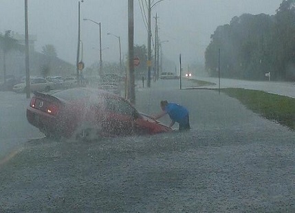
Forecasters say Ian is poised to spend days dumping rain on Florida after it makes landfall as a hurricane, a troubling scenario that could lead to widespread flooding and damage.
Ian is likely to impact the entire state, with the areas in its direct path expected to see widespread damage and winds of well over 100 mph, according to Anthony Reyes, with the National Weather Service in Miami. Plus, coastal areas along the Gulf of Mexico are even more prone to storm surge floods.
Up to 76 cm of rain is forecast to fall on parts of central Florida as the storm moves inland, threatening to cause extensive flash floods, reported Reuters. Nearly 2 million homes and businesses statewide were without power as of an hour before sunset, utilities reported.
How much rain is Florida going to get?
Parts of Central Florida could see 12-16 inches of rain with 2 feet possible in isolated areas, according to the National Hurricane Center. Other areas of the state might see between 6 and 8 inches, with isolated areas getting up to a foot.
Some areas on the western coast of the state, such as Charlotte Harbor, should expect to see 8-12 feet of storm surge, the center said.
What makes Ian dangerous?
Ian is expected to make landfall in Florida, somewhere between Tampa and Fort Myers, and then continue moving through Central Florida as it weakens. It will already be moving as slowly as 5 mph when it hits, which means its path through the state will be slow.
“When these kind of systems slow down, they allow for an even more extended period of time for the same locations to receive rains,” Reyes said. “That exacerbates the potential for localized flooding.”
Reyes said the concentrated metro areas in the storm’s path are especially at risk. Flash and urban flooding are expected mid-to-late week across central and northern Florida, southern Georgia and coastal South Carolina.

“This is a storm that we will talk about for many years to come, an historic event,” said Ken Graham, director of the National Weather Service. The sprawling, slow-moving storm pushed farther inland as darkness fell, and within six hours of landfall was downgraded to Category 2, with top sustained winds of 105 mph (170 kmh), the NHC reported.
How long will it take to recover?
In some areas of the state, structural damage caused by hurricane-level winds could make some residential buildings “uninhabitable” for weeks or even months, the National Weather Service in Miami said.
